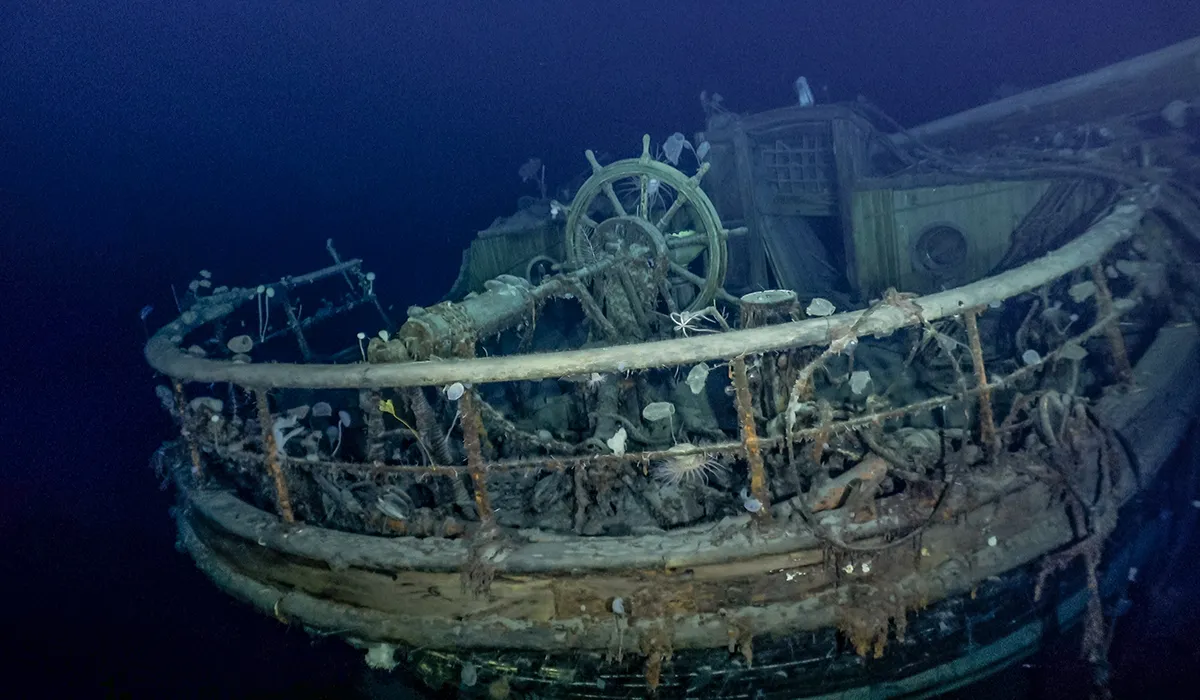
TheEndurance embarked in 1914 with explorer Ernest Shackleton and his crew on the first ever land crossing of Antarctica, but the ship had to be abandoned in the Weddell Sea.
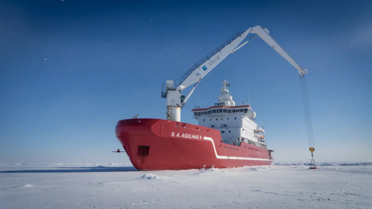
Her location remained a mystery for over a century, until a team of scientists discovered Endurance, amazingly preserved, on the seafloor. Nico Vincent and Dr Lasse Rabenstein spoke to us while on board the ship that discovered her.
Why is this discovery scientifically important?
Dr Lasse Rabenstein: If I’m honest, when I first heard about this expedition, I asked that exact question. Who’s interested? We knew a lot about the ship already from the history books. But getting scientific instruments to the Weddell Sea is a rare opportunity. They aren’t many icebreaker ships in the southern hemisphere that can make it into the ice of the Weddell Sea. Shackleton’s expedition did not, by coincidence, get stopped in the Weddell Sea. It has really heavy ice conditions. So, every chance to get in-situ data samples from the Weddell Sea should be taken.
Finding the wreck itself was motivating, and people were really creative in their way of thinking. We combined all the different fields of science, research, navigation, subsea technology, archaeology, all working together to achieve that goal. Without it, we wouldn’t have developed new technologies for observing and navigating the ice – the expedition was the first to use Sabertooth underwater vehicles, made by Saab.
How did the Sabertooth vehicles help you find Endurance?
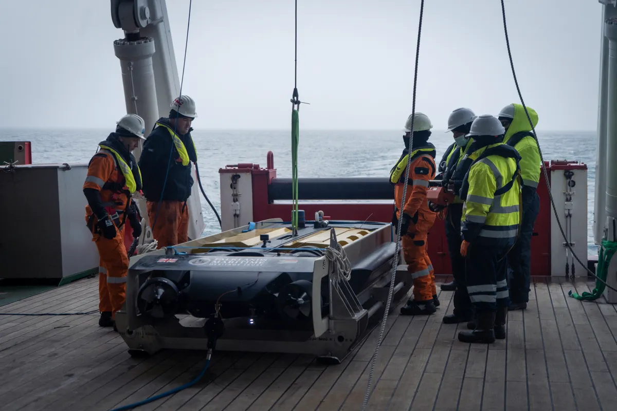
Nico Vincent: We identified and built several solutions to find the ship. No divers could be deployed, as the wreck is too deep for humans. The deepest a diver has reached is 700m, but the wreck is 3000m. Only robots can dive to that depth.
Accessing that depth in open water is extremely complicated and requires high technology and a strong experienced team. However, to make it under drifting ice [like in the Weddell Sea] is harder than landing on the Moon was in 1969.
Sabertooth’s main advantage is as a hybrid vehicle, both an Autonomous Underwater Vehicle and Remote Operated Vehicle. That means we can switch Sabertooth from following a dedicated task plan in full auto mode to a real-time manual remote drone. Keeping real-time control on the vehicle allows us to record real-time data and also make fast decisions. As soon as the Endurancehad been detected, we stopped the initial task plan and proceeded straight to our target for formal identification.
You mentioned other scientific opportunities presented by the expedition. What did you learn?
LR: Scientists study the sea ice in the Arctic and the Antarctic because this ice is very important for the global climate. Sea ice acts as a gigantic mirror for the Sun's rays, reflecting solar energy back into the atmosphere and space. This has a cooling effect on the global climate.
If ice disappears, due to a warming or to another effect of climate change, then there is open ocean, which absorbs a lot of this solar energy and heats up the planet even more. This is also called the ice-albedo feedback mechanism.
So, it's very important to understand how sea ice changes and reacts to global warming. Normally, people study this ice from space, using satellite missions and imagery to take measurements of ice thickness, sea surface temperatures, ice temperatures.
[Scientists] have super complex numerical models running that can simulate sea ice processes and the effect on global climate. But, this is only trustworthy if you can get to the Weddell Sea and other ice covered regions into the world, and actually check if what your models or your measurements from space tell you is true. That means we have to collect so-called in-situ data.
What is next for the expedition?
LR: Of the 15 scientists on board, we had no biologist. When we saw the images of the wreck and we saw the marine life there, we decided it was very important to involve deep sea marine biologists and see what kind of life forms could be observed on the wreck. It will also be interesting for subsea geologists and deep sea sedimentologists to learn more about the Weddell Sea.
Navigating through ice is a very challenging thing, but there's a lot of potential to improve it with technology, and this expedition was really the start of a new future for shipping.
I run Drift + Noise, a spinoff from the German Polar Research Institute and we’re trying to set up what you could call the Google Maps of polar regions. We’ve established the software, and it was used for the first time on the Endurance22 expedition.
Using satellite Earth observation images, the captain on the bridge could navigate through the ice, even in the dark hours, even during snowfall. We could use it like a street map through the ice. Ice is changing continuously, it drifts 20 kilometres or more in a day. Leads open up – which are the ‘streets’ or paths between ice for the ship – or they can close.
This is future of ships, the shipping 4.0, I would say. Like a smart ship interconnected with the internet, exchanging data with the outside world. All the satellite imagery which served as a street map for the ship, and also the data from sensors on the ship, are transmitted to a data cloud for the development of a kind of Google Maps for the Arctic and Antarctic.
What will happen to Endurancenow?
NV: The wreck is protected as historical heritage though the Antarctica treaty. No samples have been taken from her and she remains untouched.
We have produced a LIDAR survey, taken 4K footage, and undertaken photomosaic and geophysical surveys to allow archaeologists to produce metrology and accurate studies for science publication. There are plans to construct a 3D model of the wreck, for both temporary exhibitions and permanent museum display. Her data will be recorded to a level of accuracy comparable to that of an archaeological survey on land.
What can we continue to gain from the story of Endurance?
LR: The story is truly inspiring. Shackleton had courage, and although theEndurance failed, Shackleton was successful in a way because he became a polar hero. He never stretched the risk so it became deadly. He never lost a single man's life, during everything he'd done. I think for many, Shackleton is a positive inspiration.
Our work is getting real media attention, which is a good thing. There is this phrase; you can only protect what you know. If people start to read this story and get interested in it, they might then read more about the nature, geology and climate of the Arctic and Antarctic regions. These regions, especially the Arctic, are the ones changing fastest due to global warming. But [with more] awareness we have a better chance of protecting them and our climate in the long term.
About our experts, Nico Vincent and Dr Lasse Rabenstein
Nico Vincent is the Expedition Sub-Sea Manager onboard the Endurance22 exploration.
Dr Lasse Rabenstein is the Chief Scientist for the expedition team that foundEndurance.
Read more about satellite imagery: