
The world is entering a “danger zone of extreme weather” as the El Niño weather phenomenon starts to be felt, UN chief António Guterres recently said.
His warnings have been echoed by governments, charities and scientists around the world.
El Niño always plays havoc with global weather by changing wind patterns and releasing extreme heat and warm water. But in a world that’s warmer than ever, with increasingly unpredictable weather events, it’s little wonder this El Niño is being seen as “supersized”, in Guterres’s words.
From wildfires in Indonesia to heavy rains in Peru, the world is already experiencing the effects. And within the US, different states will be hit in very different ways.
California
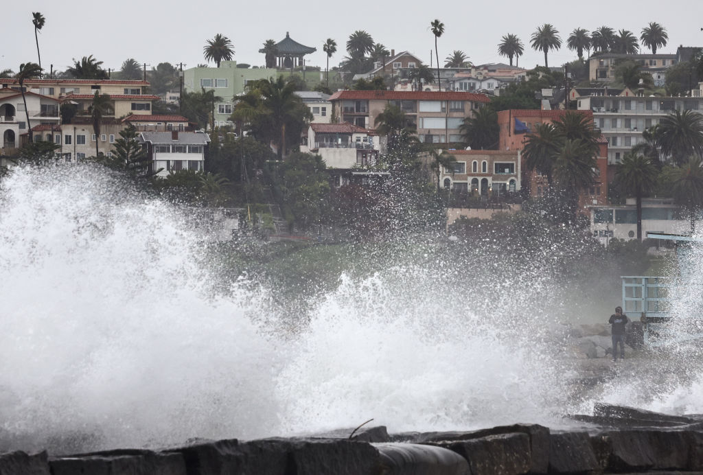
The third-largest state is perhaps the one most at risk of the effects of El Niño – and the danger comes in two forms.
The first is from the sky. California receives only a few months of rain a year, in winter. A small shift in the path of storms barrelling in from the Pacific, as can happen during El Niño, can move those rains away and lead to drought, or act as a firehose pointing directly at the state.
Some previous El Niño events have brought significant rains to California, and south and central parts have received close to double their annual rainfall during these times, says Dr Daniel Swain, a Colorado-based climate scientist who writes the Weather West blog.
“It is entirely possible that parts of California see close to, or even in excess of, double their average seasonal precipitation as a result of this event,” he says.
The second danger comes from the sea. More powerful storms fuelled by warmer seas and a stronger El Niño could coincide with larger waves and so-called king tides.
At some point, we can expect significant coastal flooding and erosion, Swain says.
“It’s not just these mansions overlooking the ocean on the cliffs that are at risk from the large, battering waves,” he says. “It’s also the transportation corridors in these regions.”
He names places like San Francisco Bay, San Diego Bay and the Sacramento-San Joaquin Delta region as large coastal populations in potential danger.
“There are millions of people living within several feet of sea level, in both northern and southern California, away from the immediate coast, who are actually at risk of saltwater flooding from ocean rise.”
Hawaii
The effects of El Niño are already being clearly felt on the archipelago. “There have now been two major hurricane events in Hawaii this summer, in a place where ordinarily we go a decade with none,” Swain says.
Warming waters in the Pacific have increased the risk to Hawaii from such supercharged storms. In August, Hurricane Lala became the first hurricane to make a direct hit on Big Island since 1871.
Just weeks later, Hurricane Lowell, a Category 2 storm, caused significant damage to the island of Kauai.
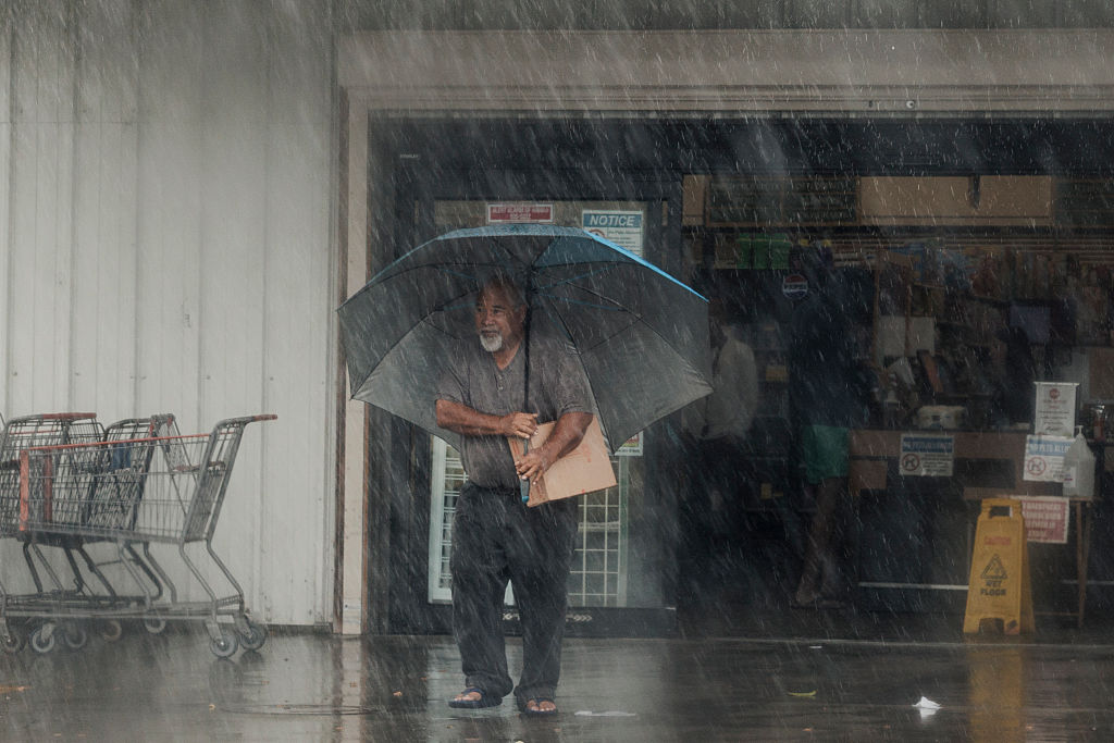
The waters in the eastern and central Pacific around Hawaii are normally cool. But when they heat up, it can lead to a collapse in the trade winds – and even cause them to change direction from west to east. That would mean warmer air over Hawaii – which would then lead to drought and less fresh water.
“There is a virtual guarantee of significant drought conditions developing there,” Swain says. “We may well go from a period of overabundance on some of these islands to a period of water scarcity, and, as we’ve seen in recent years, there is considerable wildfire risk even in Hawaii.”
In August 2023, the deadliest wildfires in the US in a century struck the Hawaiian island of Maui, killing 102 people and causing at least $5.5bn of damage. At the time, large parts of Maui were suffering drought.
Florida
Historically, the southeasternmost state has tended to be in the crosshairs of Atlantic hurricanes, from Donna to Andrew to Helene. But not this year.
In the eastern Pacific, where the waters are hotter than ever due to El Niño, it’s been a relatively active hurricane season, as Hawaii shows. But this year not a single hurricane has formed in the Atlantic, setting a new record.
This is because of a stronger wind shear during El Niño – simply put, stronger easterly winds are helping break apart storms before they can gather strength.
But it’s not all good news for Florida. The National Weather Service reports that the number of tornadoes there doubles during El Niño years.
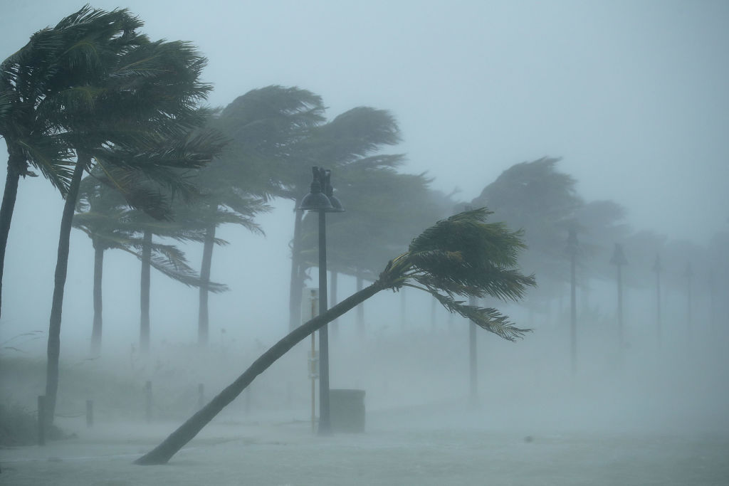
Expect more rain and flooding, too – especially around rivers.
“Florida, and the Southeast US in general, has one of the most reliable El Niño impacts of anywhere: El Niño winters tend to be rainier,” says Dr Emily Becker, a climate researcher at the University of Miami.
“El Niño increases both the frequency and intensity of winter daily rainfall in Florida, so the expectation is for more rainy days, and heavier rain, too.”
In some parts of Florida and the Carolinas, the rain could be welcome due to a recent drought, Swain says. “But there’s a good chance we’ll go from scarcity to overabundance now.”
He adds that there was also a pattern of “severe thunderstorm outbreaks” in Florida during strong El Niño years. So there’s plenty to watch out for.
Oregon and Washington
The same shift in the jet stream that brings rain to California affects its northern neighbours in a different way: the northwestern states are likely to see warmer, drier conditions over the coming months.
During an El Niño event in 2015, a series of wildfires in Washington state destroyed 123,331 hectares (304,782 acres) – this remains the largest such event in the state’s history.
Warmer temperatures also mean less snow on higher ground. And with less snow melting later in the year, that means less fresh water – and therefore the risk of drought and wildfire increases.
When the supply of fresh water becomes less reliable, it also tends to hit salmon stocks, according to the National Oceanic and Atmospheric Administration (NOAA). And warm ocean temperatures can badly affect the sea fishing industry too: cold-water species that usually thrive off the Oregon and Washington coasts are forced north, shifting the whole food chain with them.
In Oregon alone, where fishing generated an estimated $517m in revenue last year, that’s bad news.
Read more:
