Homo erectus first arrived in Britain around three quarters of a million years ago, bringing with them the ability to fashion crude flint tools, which were used in the butchering of animals. It was a time when Britain was still attached to Europe, by a landmass that eventually became submerged with rising sea levels at the end of the last ice age.
Over the following millennia, we Homo sapiens roamed the land looking for flints with which to make increasingly sophisticated tools. We also sought metals for weaponry, gold for decoration and stones for building religious sites like Stonehenge. Coal was important too, not just for smelting ores but for burning limestone to fertilise the land in order to secure a reliable supply of food.
During our search for these resources we accumulated an indigenous knowledge about where such assets might be found and the rock types in which they were located. Chalk, limestone, granite, sandstone, clay and many other rock types were probably recognised from very early times. But it was not until we really understoodfossilsthat we could put this knowledge to best use.

In 1027, the Persian philosopher Avenica first outlined the foundational principle ofgeology. It stated that sedimentary layers are deposited in sequence, with the oldest on the bottom and the youngest on top. This ‘law of superposition’ was fully formulated in 1669 by the Danish scientist Nicolas Steno, who reasoned that strata were formed when particles suspended in water fell to the bottom, creating horizontal layers. Any deviation from the horizontal was due to a later disturbance. While Steno was not the only naturalist of his day to propose that fossils had once been living creatures, he argued for the first time that fossils were snapshots of life at different moments in Earth’s history. Over the following centuries there were many opposing theories, but once these two principles had been established, the stage was set for a greater understanding of what fossils could tell us.
Underground science
During the Industrial Revolution, Britain needed large amounts of coal and raw materials to be transported around the country. That led, in the mid 1700s, to a period of extensive canal-building. In 1794, the surveyor William Smith was supervising construction of the Somerset Coal Canal. Excavations started in July 1795 in a west-to-east direction along two parallel valleys, about 3km (1.8 miles) apart. As the excavations proceeded, they revealed the gently dipping strata one by one, allowing Smith to compare the layers in one branch of the canal with those in the other. This allowed him to work out the order in which the strata had been laid down. Furthermore, he noticed that each layer had a characteristic suite of fossils which “always succeed one another in the same order”. It was therefore possible to match two strata containing the same suite of fossils, even though they were miles apart.
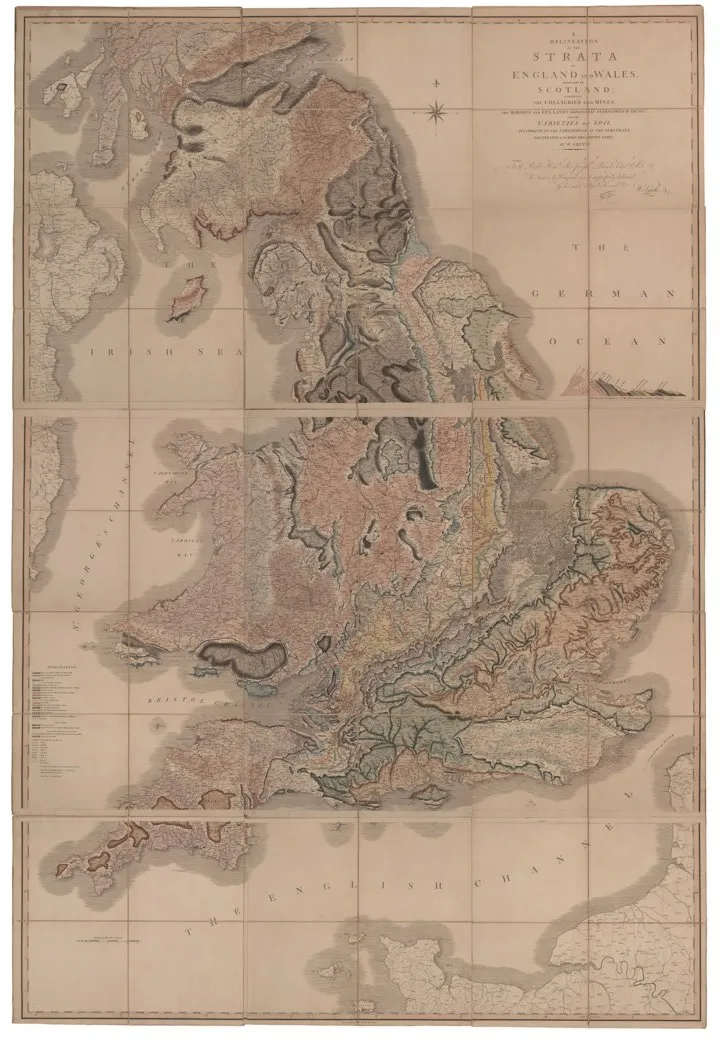
Using this method of correlating fossils, Smith was able to detail the 23 strata that lay between the Chalk (Cretaceous) and the Coal Measures (Carboniferous) in the area around Bath. This proved to be an advance of enormous magnitude, since his stratigraphic column provided a standard against which rocks anywhere in the country could be compared. Strata that had previously been given different names could be identified as being one and the same. When Smith realised he could make maps to display the strata by giving them different colours, he produced the first-ever large-scale geological map in 1799. He followed this map of Bath with the first geological map of Britain in 1815.
Smith’s ideas spread quickly. By 1812, even before Smith had published his map of Britain, the metallurgist David Mushet had created a geological cross-section of the Forest of Dean coal basin. Mushet had come to the Forest of Dean in search of iron and coal, and his work correlated the different coal seams. He used data taken from strata revealed in boreholes across the region – boreholes drilled in the search for coal and iron. This early use of borehole data meant Mushet could also correlate rocks overlying coal seams in the Forest of Dean with those overlying coals in the Welsh, Bristol and Somerset coal basins. This enabled him to predict where coal might be found elsewhere.

Despite these advances, geology was still an infant science. At that time, the word ‘fossil’ meant anything that had been dug out of the Earth and included minerals and archaeological artefacts as well as organic fossils. The word ‘palaeontology’ wasn’t coined until 1822 and the word ‘scientist’ was first published as late as 1834. It’s telling that in 1804, when writing one of the first books on fossils published in English, James Parkinson (who also identified Parkinson’s disease), complained about the difficulty of writing about a science with no name.
The Geological Society
Nevertheless, interest in geology was growing rapidly, due largely to the demand for coal, iron and other metals. In 1807 this led to the establishment of the world’s first Geological Society in London. One objective was to identify where Britain’s wealth lay underground and another was to sort out the geological nomenclature.
In every part of the country, the same rocks had different names, making it extremely difficult to know if two rocks were identical if they did not contain fossils; fossils are in fact found in only 15 per cent of rocks. To this end the Society’s first President, George Greenough, invited people to send in geological information from their local areas. Over the next decade, maps, rocks and details about geology flooded in from all over the country. Such was the Society’s success it had to move premises three times to accommodate all the material!
Progress during geology’s golden age, the 1830s, was swift. By the 1840s all the geological periods from the Tertiary to the Cambrian had been identified and named, except for the Ordovician. A ‘period’ is a subdivision of geological time that enables cross-referencing of rocks and geological events from place to place. Periods are grouped into eras, and eras into eons. The younger periods posed few problems because they mostly contained large numbers of fossils, which enabled their chronology to be ordered quite easily. The older periods were more controversial, however. They contained fewer fossils so were harder to position accurately relative to each other. In addition, older rocks have often been deformed and overturned, making it more difficult to understand the original sequence.

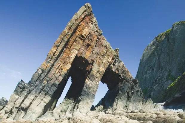
In 1832, Henry Thomas De la Beche undertook a geological survey of Devon. This work eventually led to the establishment of the Geological Survey in 1835, but not before De la Beche had suffered great public embarrassment. While he mapped the strata in Devon, his colleagues Roderick Murchison and Adam Sedgwick were similarly engaged in Wales, respectively establishing the Silurian and Cambrian systems. Everyone assumed that the rocks in Devon were around the same age as those in Wales. But in 1834, when De la Beche found Carboniferous fossils in coals embedded in the middle of rocks he thought were Silurian, he declared that William Smith’s theory of ordering the rocks using the fossils they contained must be wrong. Murchison leapt to the attack even though he had never examined the Devonshire strata himself. This deeply offended De la Beche, who believed that the validity of field work should not be questioned on theoretical grounds.
When Murchison and Sedgwick examined the Devonshire rocks themselves in 1836, they found that De la Beche had made a mapping error. The coal deposits were in fact at the top of the Devonshire strata rather than in the middle, so they assumed the coal must lie at the bottom of the Carboniferous, sitting on the older Silurian rocks – what’s known as an unconformity. De la Beche was publicly criticised and the fledgling Geological Survey was nearly brought to an untimely end. But the arguments didn’t end there. De la Beche was forced to admit his error, but he insisted that there was no unconformity between the coal strata and the older Silurian rocks. To their discomfort, Murchison and Sedgwick could not identify an unconformity either and had to admit that there wasn’t one.
The DevonConundrum
There followed much debate and extensive investigations ranging as far afield as Russia, where in 1840 Murchison discovered a layer similar to the coal found in Devon, positioned between well-defined Silurian and Carboniferous deposits. This finally put an end to what became known as the Great Devonian Controversy and led to the definition of a new period called the Devonian. It also led to a fundamental change in geological practice and the value of fossils as stratigraphic indicators was established beyond question. Fortunately, the Geological Survey survived this early trauma and De la Beche became its first Director. Both the Geological Society and the Geological Survey still exist today.
By the late 19th Century, geologists recognised that rocks were made up of individual minerals, and it was the size and composition of these minerals that determined the type of rock. There were three basic types – igneous, sedimentary and metamorphic – but as geological mapping became more refined, a more precise classification was required. It became necessary to identify which minerals were present and in what quantities. However, while it was possible to see minerals with the naked eye in rocks such as granite, other rocks such as basalts were harder to classify, because the minerals they contain are extremely small.
Until the 1860s, geologists would crush up rocks to a coarse powder and examine them under the microscope, but identifying minerals this way was rather crude, and it was very difficult to accurately measure the proportions. It was not until polarised light was applied to the study of minerals under the microscope that a systematic identification of rocks became possible.

The first steps weretaken by Henry Sorby, who prepared thin sections of minerals and fossil woods for microscopic investigation. A thin section, as the name suggests, is a polished slice of rock so thin that you can see through it. When placed between pieces of glass on a polarising microscope, each mineral in the rock slice displays different optical properties – mainly colour and shape – that can be used to identify it very accurately. This finally established a scientific method for classifying rocks and was to transform our ability to distinguish one rock from another.
The geology of the British Isles is renowned for its diversity. Rocks of almost all geological ages can be found and mapping them over the past two centuries was the single most important contribution to our understanding of our islands’ geology. Then in the 1960s, development of the theory of plate tectonics began to unravel Britain’s complex tectonic history. Over the past four billion years or so, as Britain wandered the globe, it accumulated a record of warm and cold seas, deserts, tropical swamps, giant rivers, glaciations, earthquakes, volcanic eruptions, continental collisions, and the evolution of life as preserved in its fossils. Our knowledge of that record has slowly accumulated, but even today we still don’t comprehend it all.
Follow Science Focus onTwitter,Facebook, Instagramand Flipboard