Weather – A Force of Nature, released on 4 November,presents the best images from the first five years of the Weather Photographer of the Year, the annual competition held by the Royal Meteorological Society.
The book is a collection of unforgettable images of dramatic weather events from around the globe, extracts of which we feature below.
They depict dramatic weather phenomena and each reveal fascinating stories about what causes these events and how they impact on the environment. Each image has been specially selected by a panel of meteorologists, photographers and photo editors who look for a combination of skilful camera work and meteorological observation.
The themes that are touched upon are the changing climate, extreme weather, the oceans, the poles and the impact of the climate on life.
The Royal Meteorological Society is the Professional and Learned Society for Weather and Climate. The Society serves anyone whose work is affected by the weather or climate, or simply have a general interest in the weather. The membership includes scientists, practitioners and a broad range of weather enthusiasts with membership open to anyone with an interest in weather and climate.
Rolling shelf before the storm
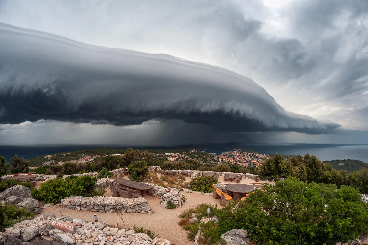
A stunning arcus cloud rolls across the Croatian coastline near Mali Losinj. Arcus clouds form at the gust front of thunderstorms, whichis the leading edge of the rain-cooled air flowing out from the storm. The best examples usually occur when individual storm cells merge into larger clusters and lines of thunderstorms. The rain-cooled air from individual storms then combines into a much larger region of cold, dense air that can help to propel the area of storms forward as it spreads outwards. Arcus clouds that are as well-formed and extensive as the one photographed here are often accompanied by damaging wind gusts.
Mountain thunderstorm
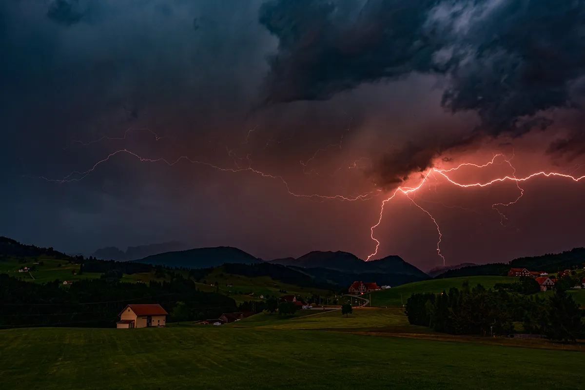
Pink-tinged lightning illuminates the mountains near Appenzellerland, Switzerland, during a powerful nocturnal thunderstorm. Robert says, "This photograph was taken in front of my house in Appenzellerland, Switzerland. As the storm developed I stood on my terrace to watch and photograph the spectacle. The flash frequency was quite high, which meant that I could work with relatively short exposure times. I particularly like this shot because of the ambient light in the clouds, and the beautiful pink colouration of the lightning which provides contrast with the green of the landscape."
Painting in the sky
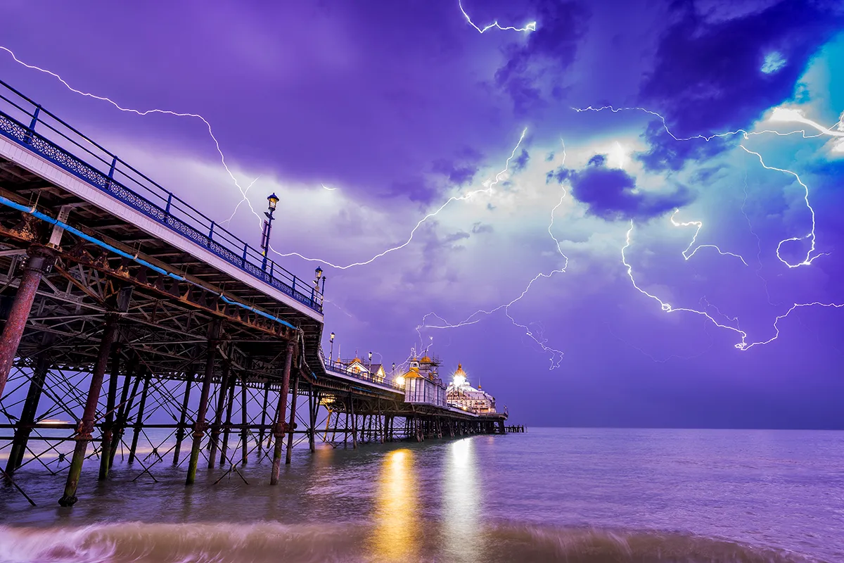
A complex array of lightning channels streak across the sky above Eastbourne Pier on the south coast of England during an overnight thunderstorm. Thunder occurs as a result of intense heating of air surrounding the lightning channel. The heated air expands rapidly, which sets up shock waves that radiate outwards in the form of sound waves that we hear as thunder. When a bolt of lightning strikes close by, the thunder is sudden and may sound almost like an explosion, but with increasing distance the sound waves tend to disperse, leading to the rumbling sound that is perhaps more familiar. The sound waves from different parts of the lightning channel, at greater or lesser distances from the observer, take varying amounts of time to reach the observer, which also explains why thunder tends to last several seconds and why a single roll of thunder often comprises multiple peaks and troughs in volume. Thunder is typically audible up to about 16 to 24km from the lightning, though this varies according to the atmospheric conditions.
A pink dusting
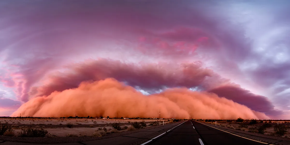
On 9 July 2018 a line of severe thunderstorms moved from east to west through the state of Arizona, USA, producing one of the largest haboobs (dust storms) on record. It measured almost 11km high and travelled nearly 320km, crossing the border into California after dark before dying out. This panoramic image was taken near Yuma, Arizona, where the leading edge of the dust storm formed a wall that stretched almost from horizon to horizon as it approached at sunset. The last rays of the evening sun give the haboob its beautiful pink hue. The close association of haboobs with thunderstorms is self-evident in this example, given the presence of a spectacular shelf cloud; the dense roll of cloud that forms along the leading edge of a thunderstorm, which can be seen to fill much of the sky above the advancing wall of dust.
Waterspout party
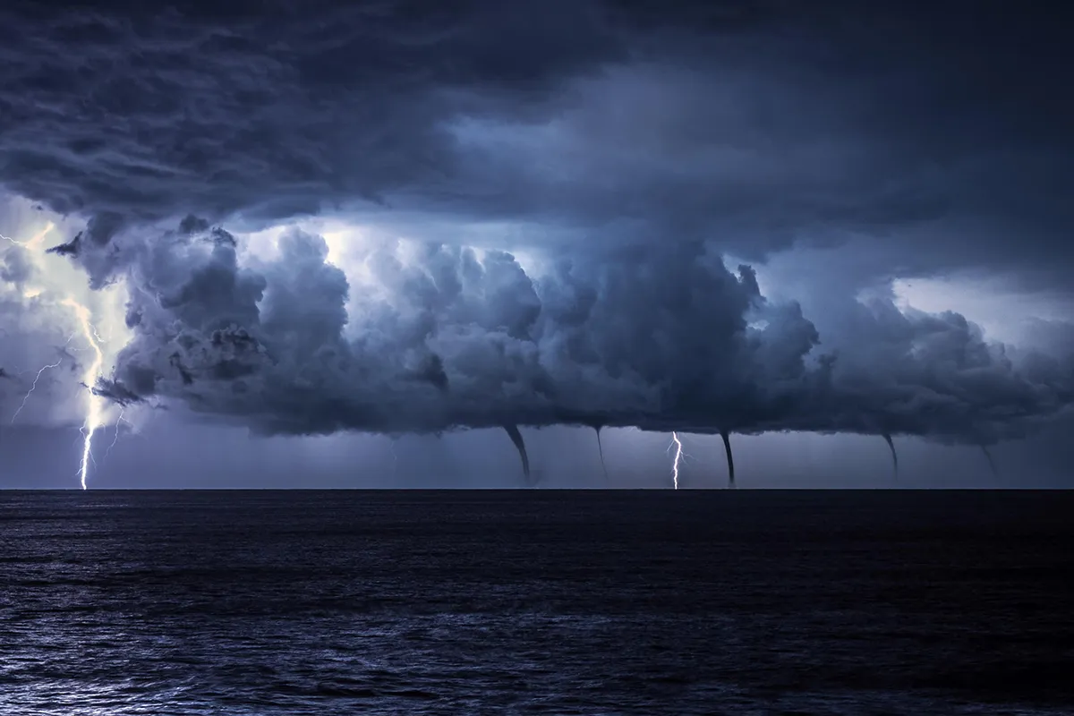
A rare spectacle unfolds as multiple waterspouts develop underneath the base of a line of storms over the Adriatic Sea, as seen from near MaliLosinj, Croatia. Waterspouts are simply tornadoes occurring over water. They are particularly common in the autumn and early winter months over the Mediterranean Sea and adjoining water bodies, when outbreaks of cold air spread over the still-warm waters, creating strong instability. In this example, the fact that the waterspouts are arranged in a line suggests that they have developed along a well-defined convergence zone; a boundary where winds of differing speeds and directions meet. As the air converges it is forced to rise, creating a line of towering clouds. The differing wind speeds and directions generate spin along the boundary which, when ingested by the rising air and stretched in the vertical, may be amplified to tornadic strengths, resulting in development of the waterspouts.
Mammatus highway
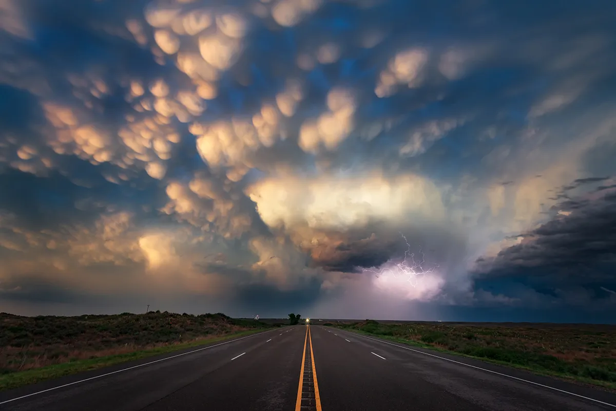
Mammatus clouds on the edge of a severe thunderstorm in the Texas Panhandle, USA, catch the very last rays of evening sunlight. A common misconception is that the presence of mammatus signifies that a tornado is about to form. Although mammatus clouds are usually associated with well-developed cumulonimbus clouds, which can produce tornadoes on occasion, the vast majority of cumulonimbus clouds do not produce tornadoes, which means the presence of mammatus is not a reliable indicator of tornadic activity in itself. The mammatus may, however, be a more reliable indicator of the presence of other hazards associated with thunderstorms such as severe turbulence and lightning.
Check out some of our other great image galleries
- Got my eye on you: Capturing Ecology photography awards 2021
- Winners of the Wildlife Photographer of the Year 2021
- The World's largest capture capture plant in action
After the Fire
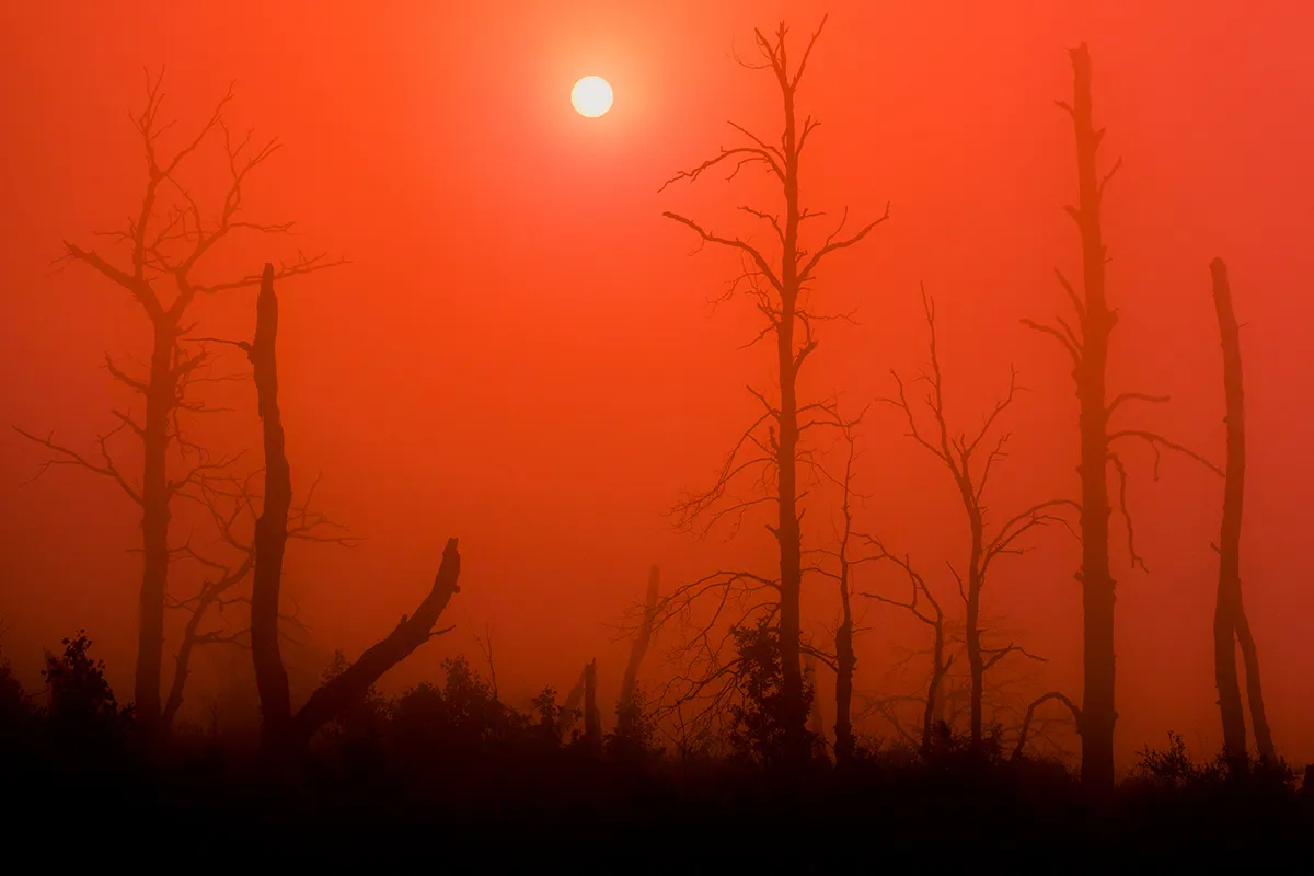
An unearthly scene is encountered in the aftermath of forest fires in the Bizhbulyaksky District of Bashkortostan, Russia. Although it is often difficult to attribute individual weather events to climate change, current projections show that it is very likely that temperature and rainfall extremes will increase in a warming world. Where high temperatures coincide with unusually prolonged or acute droughts, forest fires are all too often the catastrophic result. Wildfires also contribute to global warming in themselves, because they release large amounts of carbon dioxide into the atmosphere, and because they destroy vegetation that would otherwise have helped to remove carbon dioxide by photosynthesis.
A city afloat
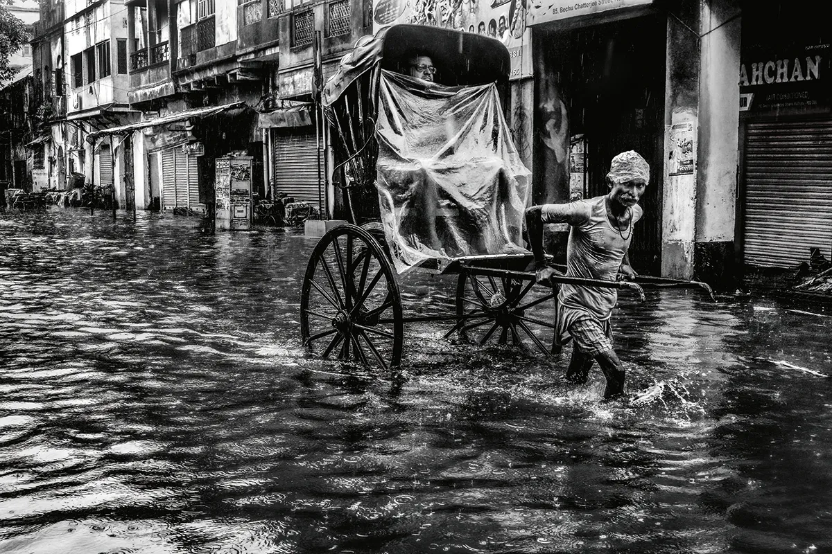
A hand-pulled rickshaw struggles through the flooded streets of Kolkata during the monsoon season. Although the Indian Monsoon occurs with a fairly regular seasonal cycle, significant variations can occur in the intensity and timing of the monsoon rains from year to year. Where monsoon rains fail, the results can be catastrophic. Although crops require the monsoon rains in order to grow, excess rainfall can be really problematic, creating widespread flooding that can displace millions of people. The most dangerous flooding events in the region are often associated with landfalling tropical storms in the Bay of Bengal. In May2020, an exceptionally powerful tropical storm called Cyclone Amphan struck Bangladesh and eastern parts of India, with sustained wind speeds of over 240kp/h. A storm surge and exceptionally heavy rainfall combined to create widespread flooding. In Kolkata, 240mm of rain was recorded.
Flash floods in the desert

Salar de Uyuni, in southwest Bolivia, is the world’s largest salt flat, covering an area of approximately 10,000 square km. Up to approximately 12,000 years ago the area was coveredby a giant lake, but the water evaporated over time leaving behinda thick crust of salt. In today’s climate, the Bolivian Salt Flats arearid, experiencing less than 200mm of precipitation a yearon average. Whilst deserts are characterised by their general lack of precipitation, occasional heavy rainfall events do occur in many ofthe world’s deserts. These events tend to be brief but intense, and sometimes result in flash-flooding as the water runs off the parched, largely unvegetated ground. In the Bolivian Salt Flats, rainfall occurs most frequently in January. Sometimes, as here, water ponds on the surface of the salt crust after rainstorms, creating a spectacular mirror-like effect.
Teeth of Ice
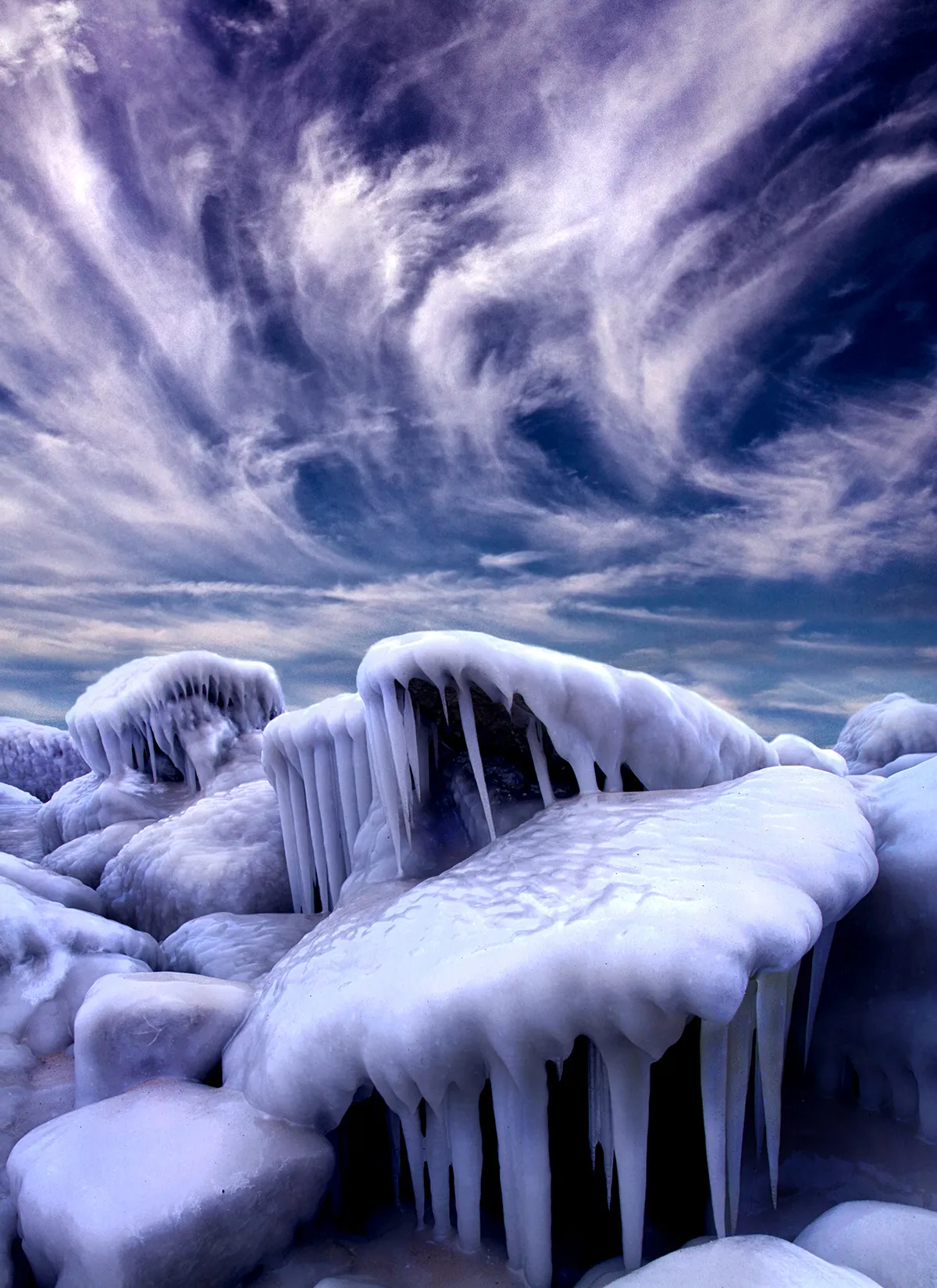
Extreme cold and wind-blown spray combine to create a spectacular ice-bound landscape on the shores of Lake Michigan in Wisconsin, USA. For ice formations to build up like this, a substantial period of sub-zero temperatures is required in order for the surface of the lake to freeze. The time lag between the onset of sub-zero air temperatures andthe freezing of the lake is due to the large heat capacity of water; a great deal of energy must be lost to the surroundings in order for the temperature of the lake to decrease appreciably, and so the lake cools much more slowly than the surrounding land surface and overlying air. Early in the winter, when the lake is still ice-free but air temperatures are already well below freezing, waves crashing onto the shore create spray that freezes quickly on contact with objects near the shoreline.
Fortress of ice
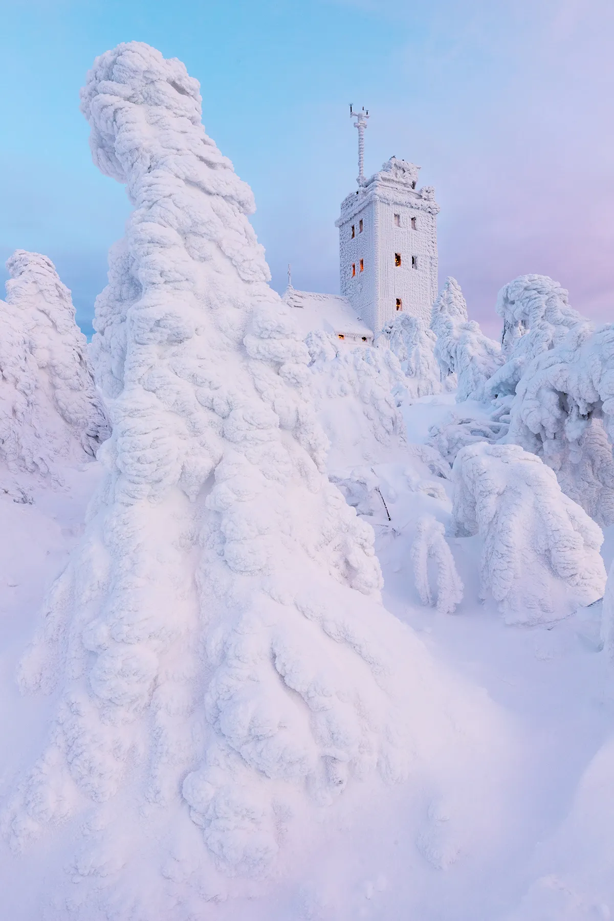
Snow and rime icing in the Erzgebirge (Ore Mountains) in Saxony, eastern Germany. A strong wind combined with 120cm of fresh snow at -10°C created these incredible snow sculptures. Rime icing occurs when fog combines with sub-zero temperatures. The thickest deposits tend to occur on mountain tops in the winter, where sub-zero temperatures persist for weeks or even months at a time, and the cloud base is often below the summits. Very large accumulations of rime ice can build up on surfaces exposed to the wind in these conditions, with deposits sometimes exceeding a metre in thickness. The Fichtelberg (Fichtel Mountain) is often hidden by thick fog; in fact in 1951 the mountain experienced fog on 315 days of the year.
Seeing double
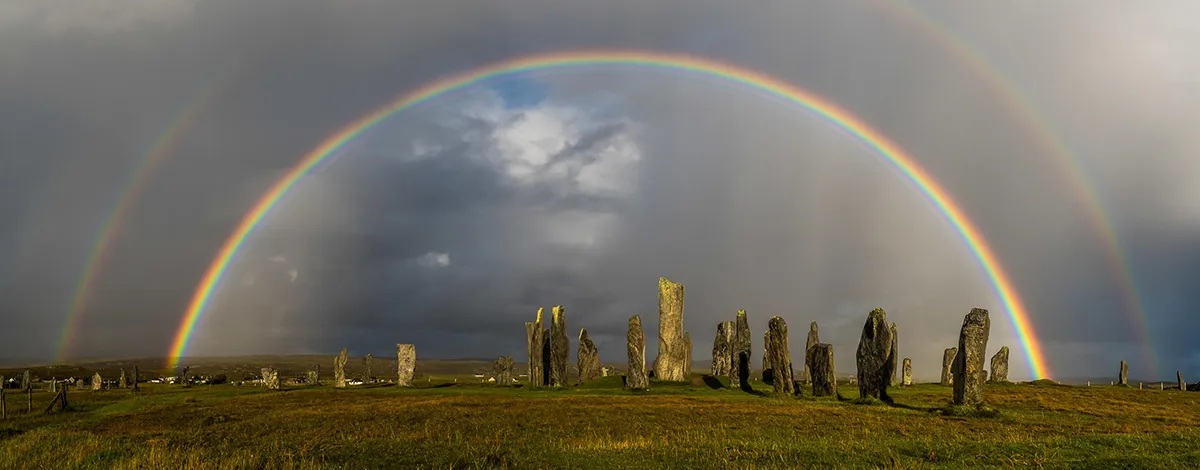
A spectacular double rainbow appears as sunshine follows a heavy shower at Calanais on the Isle of Lewis, Scotland, United Kingdom. Rainbows form due to the refraction and reflection of sunlight as it passes through raindrops. The secondary, outer bow, in which the colour banding is in the opposite direction to the primary bow, occurs when light is twice reflected off the back of the raindrops. The secondary bow always lies nine degrees outside of the primary. Between the two bows, especially near the horizon, a phenomenon known as ‘Alexander’s dark band’ is apparent; a region in which the sky appears slightly darker than it does outside of the secondary bow and inside of the primary bow. This is because reflected light tends to brighten the sky outside ofthe secondary bow and inside of the primary bow. The phenomenon is named after Alexander of Aphrodisias who first described it in AD200.
Weather - A Force of Nature: Spectacular images from Weather Photographer of the Year by the Royal Meteorological Society is out now (£25,The Natural History Museum).
- Buy now from Amazon UK, Waterstones or WHSmith
