
Landslides threaten the lives and homes of 6.5 million Americans living in danger zones, experts warn, and new research reveals where people are most at risk.
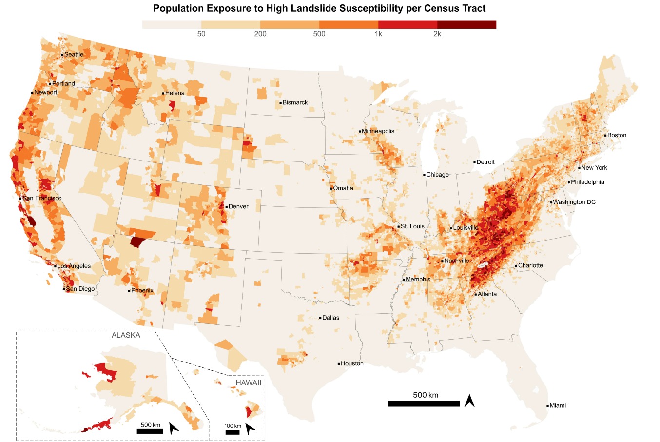
The study, published in Earth’s Future journal, is the first to explore the human geography of landslides in the United States and provides a map of hotspots around the country.
Despite most of the US’s steepest terrain being located in the west, higher population densities mean more than half the people living in a landslide hazard zone are on the east coast.
The Rocky Mountains, Alaska and Hawaii, where local communities are smaller, accounted for just 4 per cent of people living in landslide hazard zones, while states including Nebraska, Minnesota and Illinois, where terrain is flatter but the number of residents is higher, accounted for 700,000 landslide-exposed people.
Researchers combined data from the United States Geological Survey with the spatial footprints of buildings and nighttime occupancy estimates to accurately gauge the number of people living in landslide hazard zones.
The study didn't account for daytime visitors or tourists, nor did it consider landslide frequency, which tends to be elevated in the west.
Unlike wildfires and other major natural disasters which can have impacts over a wide area, landslides often only affect the immediate area, leaving surrounding regions untouched.
“The susceptibility at one location can be vastly different than the susceptibility at a neighbouring location just 10, 20 or 30 metres away,” said Prof Joseph Wartman, a civil engineer at the University of Washington and co-author of the study.
People living in rural areas are the most adversely affected – they make up 62 per cent of those residing in landslide hotspots, and yet have less capacity to recover following a natural disaster, according to researchers.
In contrast to urban areas, rural regions tend to have fewer readily available resources and a higher quantity of low-income residents. “We have found that this urban-rural divide plays out across the entire United States,” Wartman said.
Study authors hope their research is replicated elsewhere to increase awareness of landslide risk.
“This is really a template that we should be able to duplicate in other nations and other parts of the world,” said Daniel Acosta-Reyes, a civil engineer at the University of Washington and the study’s lead author.
Read more:
