They called it Black Saturday – a day in February 2009 that residents of south-east Australia will never forget. The heat had already exceeded 45°C (113°F) in places on Friday 6 February, while firefighters and the public dreaded what the dawn would bring.
By mid-morning on Saturday 7 February, blistering temperatures close to 47°C (117°F) were accompanied by winds blasting over 100km/h (62mph).
The additional combination of desiccated vegetation and extremely low humidity set the stage for the most devastating bushfires in the country’s history.
At around noon, a single power cable was downed by the winds, igniting a devastating blaze. By the evening, thousands of homes had been razed to the ground, and close to 170 people had been killed.
Elsewhere across the state of Victoria, hundreds of other fires raged, bringing more death and destruction.
And over everything hung immense thunderheads – the dark clouds that signal oncoming thunderstorms.
You might well be familiar with the term cumulonimbus, which refers to the towering clouds that often mark the end of summer sunshine and alert us to the arrival of torrential rain and lightning.
What you may not know is that similar clouds are now routinely being spotted above the unprecedented wildfires brought about by accelerating global heating.
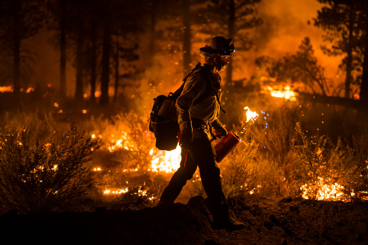
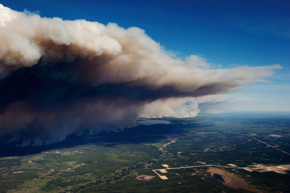
The term pyrocumulonimbus – and its abbreviation PyroCb – has only been in use since 2004, but we can be certain that these dangerous storm clouds have been around forever. They build wherever enormous quantities of heat energy are pumped into the air over a relatively short period of time.
They shouldn’t, then, be thought of as a new kind of threat, but as an old one that’s been growing bigger, stronger and more dangerous the whole time human activities have been pushing up the planet’s temperature.
In the past, PyroCbs have been identified above the huge columns of ash and gas ejected during big volcanic eruptions.
One formed over the erupting Mount Pinatubo in the Philippines in 1991 and another, more recently, developed after the shattering detonation of the Hunga Tonga submarine volcano in the South Pacific in 2022.
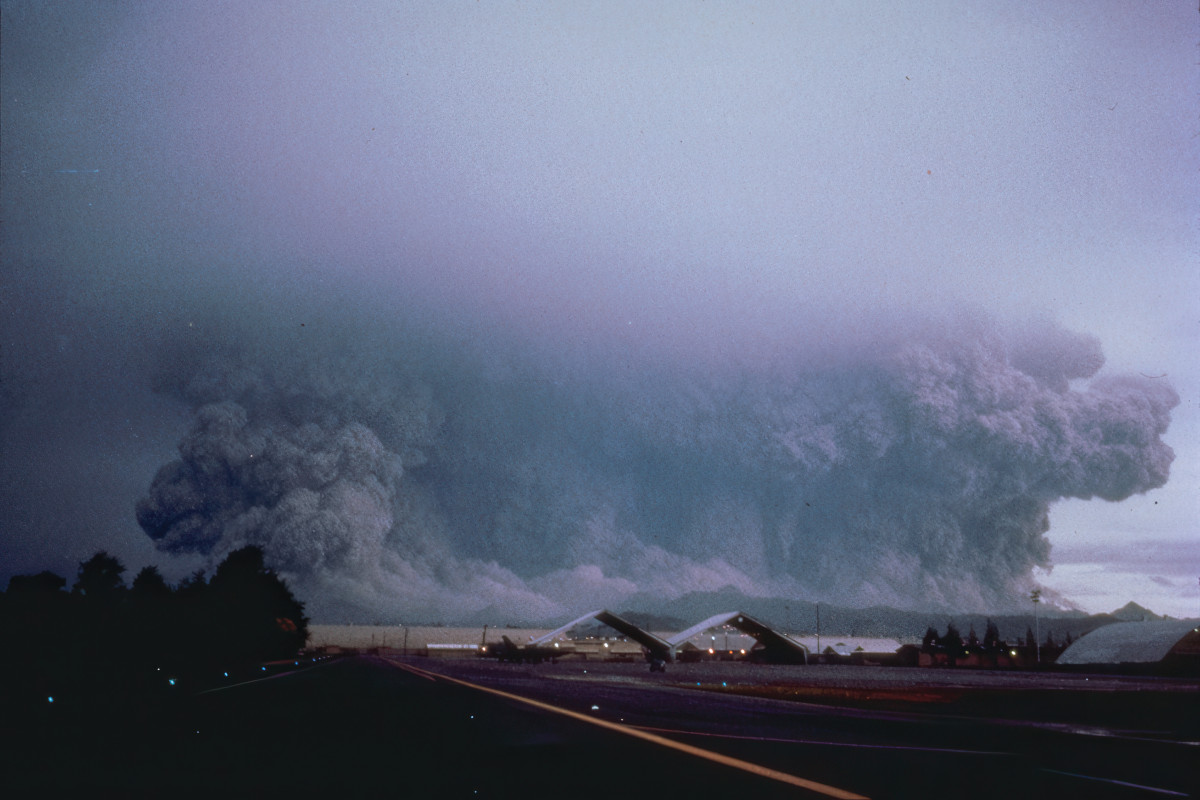
They’re also a characteristic of nuclear bomb blasts – one was recorded to have hung over the ruins of Hiroshima long after the mushroom cloud had dissipated.
Today, however, these clouds have been seen over the increasingly devastating wildfires happening in Australia, California, Spain, Greece and Siberia.
Between 2013 and 2023, a total of 761 PyroCbs were recorded worldwide – 169 instances in 2023 alone – and this number is only expected to rise as heat continues to build.
Born in the fire
The formation of a wildfire is strongly dependent on the development of so-called ‘fire weather’ – typically the combination of heat, low humidity, strong winds and super-dry vegetation that fed the Black Saturday fires – but few realise that the biggest blazes generate their own weather.
Inevitably, major fires heat the air above them, resulting in the formation of powerful air currents.
Locally, these can drive the terrifying vortices of twisting fire columns known as fire tornadoes – more on these later – but on a larger scale, strong updrafts also build the potentially far deadlier PyroCbs.
As Prof Jason Sharples, a wildfire expert at Australia’s University of New South Wales, puts it: “A pyrocumulonimbus is basically a thunderstorm within the plume of the fire”. In other words, two perils for the price of one.
Critically, these vaporous beasts are more than bystanders. On the contrary, they aid and abet the fires raging below, helping them spread further and faster.
So, how exactly do these monstrous clouds form? Well, the core ingredient is plenty of heated air rising rapidly in convection currents.
On a hot summer’s day, the baking ground heats the air above it, which becomes lighter as a result and is convected upwards. As this air reaches higher altitudes, where the pressure is lower, it expands and cools.
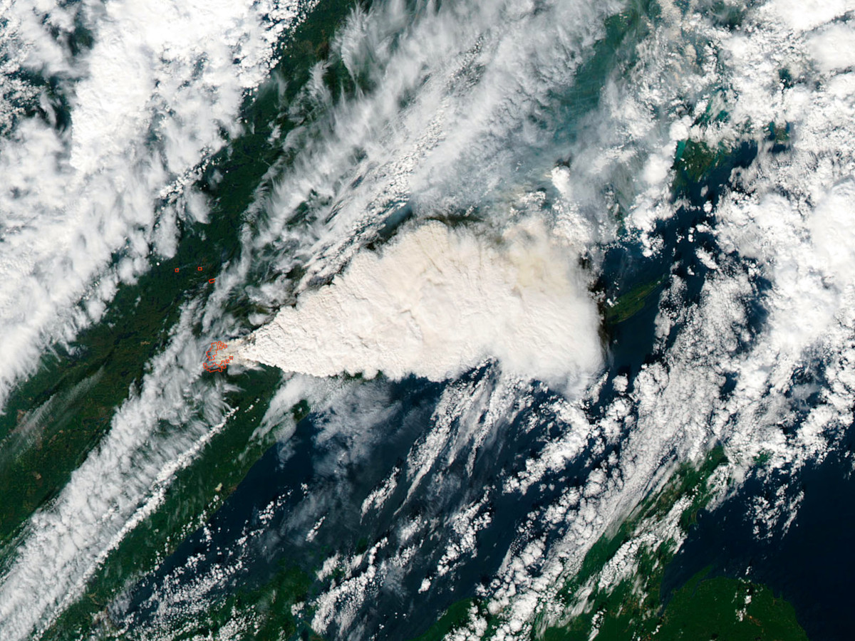
This causes water vapour to condense, forming the tiny droplets that make up clouds.
Starting off as small fluffy cumulus clouds, they will continue to grow and increase in height as long as the supply of warm air from below continues.
On the hottest days, the rising air is sufficient to build the impressive thunderheads we call cumulonimbus, which feed the torrential downpours or hailstorms that often follow a particularly sweltering day.
PyroCbs form in the same way, but the heat that drives them is far greater. The burning hearts of the most extreme wildfires can reach temperatures of 1,200°C (2,190°F) – around three times as hot as a charcoal barbecue, and high enough to melt aluminium, copper and even gold.
Consequently, the air immediately above a major inferno is heated to temperatures far above those encountered on even the hottest summer days.
It’s also important to remember that this air is full of smoke, ash and burning embers. This superheated mixture forms a hot plume that climbs rapidly, before cooling and beginning to condense.
The surfaces provided by the ash and smoke particles make condensation easy, so cloud formation can be extremely rapid.
In next to no time, a fully developed PyroCb can reach 15–16km (9–10 miles) above the surface – a looming horror of smoky grey or dirty brown – in effect a giant chimney pumping smoke and ash particles high into the stratosphere.
And PyroCbs don’t always occur in isolation. Far from it. If conditions are ripe for the formation of a single PyroCb, then they are also favourable to the development of others.
During the notorious Australian Black Summer of 2019–20, a so-called ‘super outbreak’ over the New Year period saw the development of an extraordinary 38 PyroCbs.
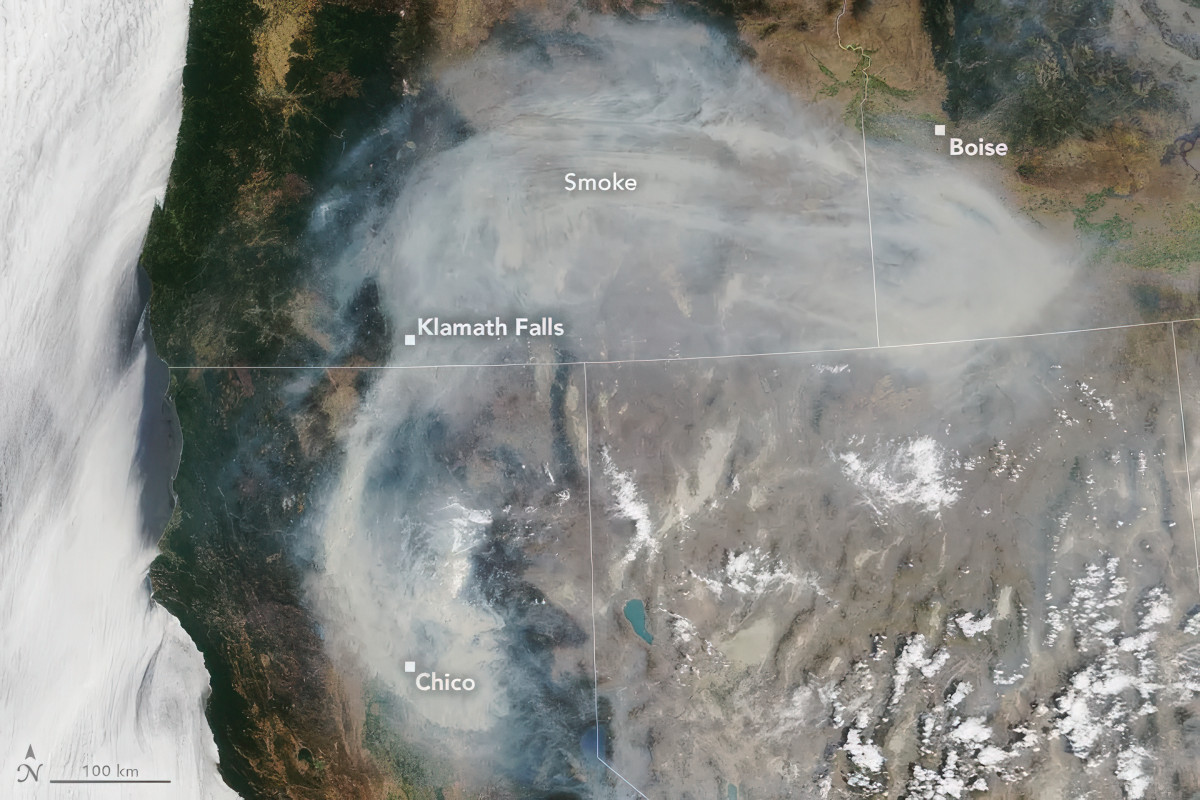
A cluster also formed over the enormous Dixie Fire – the second largest ever to hit California – which rampaged across the northern part of the state in July 2021, obliterating the Gold Rush community of Greenville.
One key feature that distinguishes PyroCbs from standard cumulonimbus thunderheads is that the fire-generated clouds don’t tend to produce much in the way of rain or hail. Consequently, they play no part in helping to damp down the fires below.
Instead, they spawn the lightning and gusting winds common to nearly all thunderstorms – both phenomena that make the perilous task of fighting wildfires all that much harder.
Lightning strikes, in particular, have the potential to help spread an existing fire, or start new ones, and can occur in colossal numbers when the conditions are right.
As wildfires stormed across the Canadian province of British Columbia, during the record-breaking heatwave of July 2021, an astonishing 112,803 cloud-to-ground lightning strikes were recorded across the province in just 15 hours.
Many, if not most, came from PyroCbs.
In 2016, lightning from a PyroCb above a wildfire in the Canadian province of Alberta started another fire 35km (22 miles) away, demonstrating the enormous reach of these storms and their capability for spreading already raging fires farther and wider.
Lightning is likely to have been responsible for starting new blazes on another fraught day in Australia’s wildfire history. Black Friday (13 January 1939) saw more than 70 lives lost and a staggering 4.9 million acres – an area about the size of Wales – burned across Victoria state.
Strong, gusting winds do a similar job to lightning, carrying embers far ahead of a fire-front, and causing so-called ‘spot’ fires as they hit the ground – advance guards, if you like, of the main fire – which can spark further major fires in their own right.
Sudden changes in wind direction can happen, too, sending the fire off onto a new heading, and catching firefighters and residents by surprise.
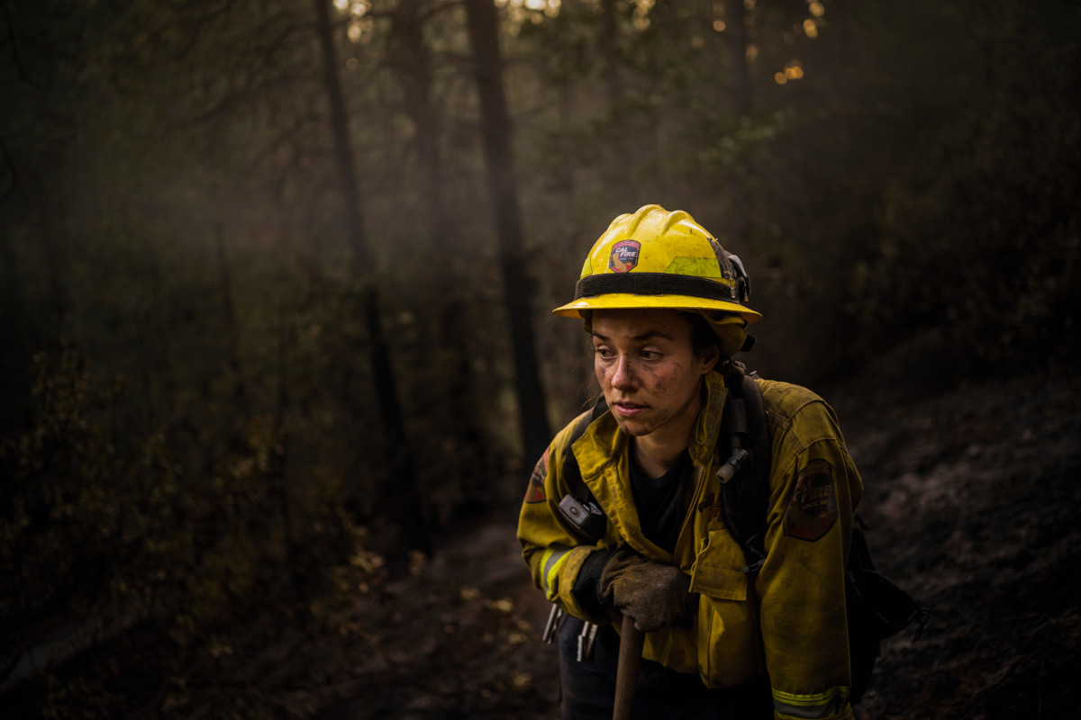
Thick, overhanging PyroCbs can also bring almost complete darkness, disrupting the work of firefighters and disorientating residents trying to flee their homes.
Read more:
- 5 times hotter than the Sun: Here's why lightning is so powerful
- Wildfire science: computer models, drones and laser scanning help fan the flames and prevent widespread devastation
- How effective are planes in fighting wildfires?
Spinning fire
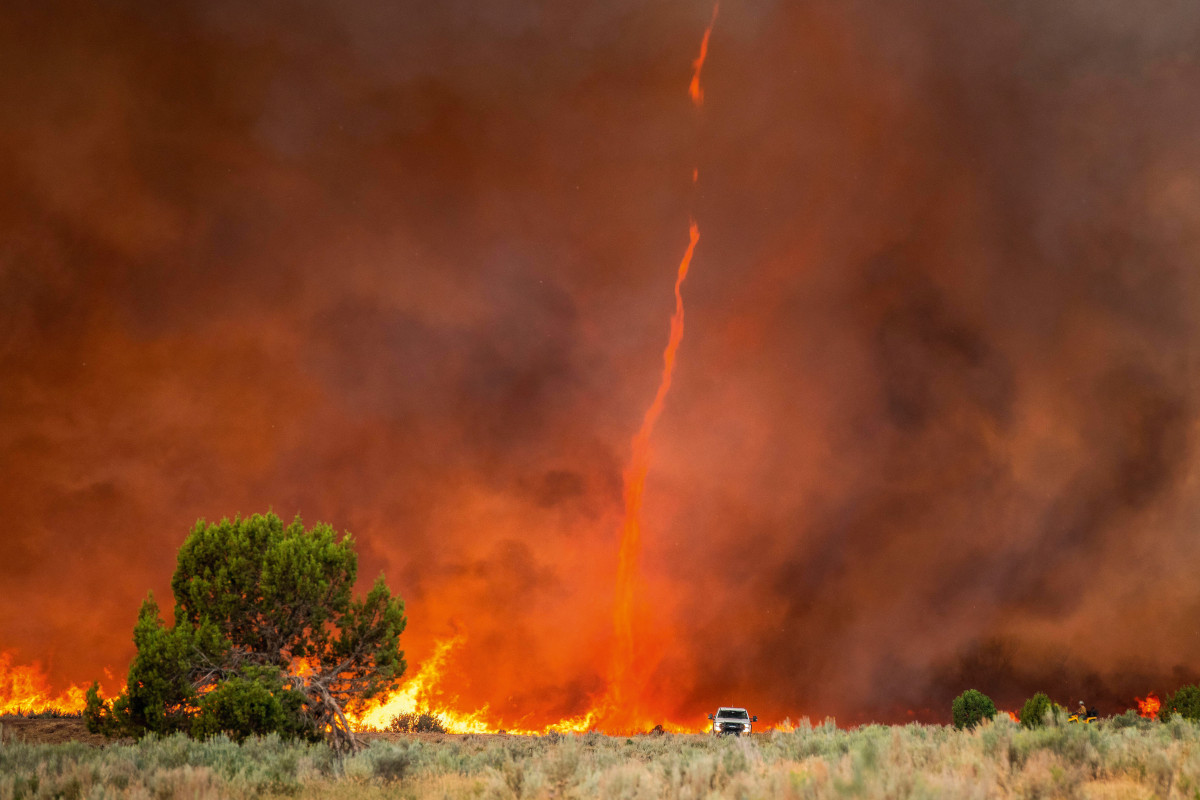
The powerful updrafts feeding the PyroCbs can also breed spinning vortices of flame known as fire whirls or fire devils. These rapidly rotating columns are usually only a few metres wide and less than about 50m (164ft) high.
They are ephemeral too, so rarely hold their form for more than a few minutes. Nonetheless, their unpredictability and the 200km/h (124mph) winds they can generate, means they can be deadly.
Far less common, but considerably more perilous, are true fire tornadoes, or firenadoes. While fire devils tend to be confined to the surface of a fire, their big brothers extend all the way down to the surface from a PyroCb overhead.
Probably the biggest ever recorded was formed in the 2018 Carr Fire, which, over the course of a week, burned almost a quarter of a million acres of northern California and destroyed a thousand homes.
The firenado stretched 5km (3 miles) into the air and approached 250m (820ft) across at its widest part. It tore across the ground for 30 minutes, ripping trees apart, blowing out the walls of buildings and taking the lives of firefighters and homeowners alike.
The temperature at its core is estimated to have been as high as 1,480°C (2,700°F) – hot enough to melt steel.
Up in smoke
While even the greatest wildfires cover very small areas when compared to the surface of the Earth as a whole, the smoke spreads far and wide.
Way back in 1950, it’s likely that the roots of a strange optical phenomenon in the sky originated from a massive wildfire in western Canada, which generated a smoke plume that extended right across the North Atlantic.
Communities in Canada, the eastern US and western Europe were entranced, and in some cases alarmed, by the smoke-affected appearances of a blue Moon and green Sun.
More recently, in July 2025, polluting smoke from Canadian wildfires shrouded New York and other northern US cities, driving down air quality and triggering warnings for vulnerable residents to stay indoors.
Worldwide, around 100,000 people a year die from the effects of wildfire smoke and the poor air quality it causes – a number predicted to rise significantly in the decades ahead.
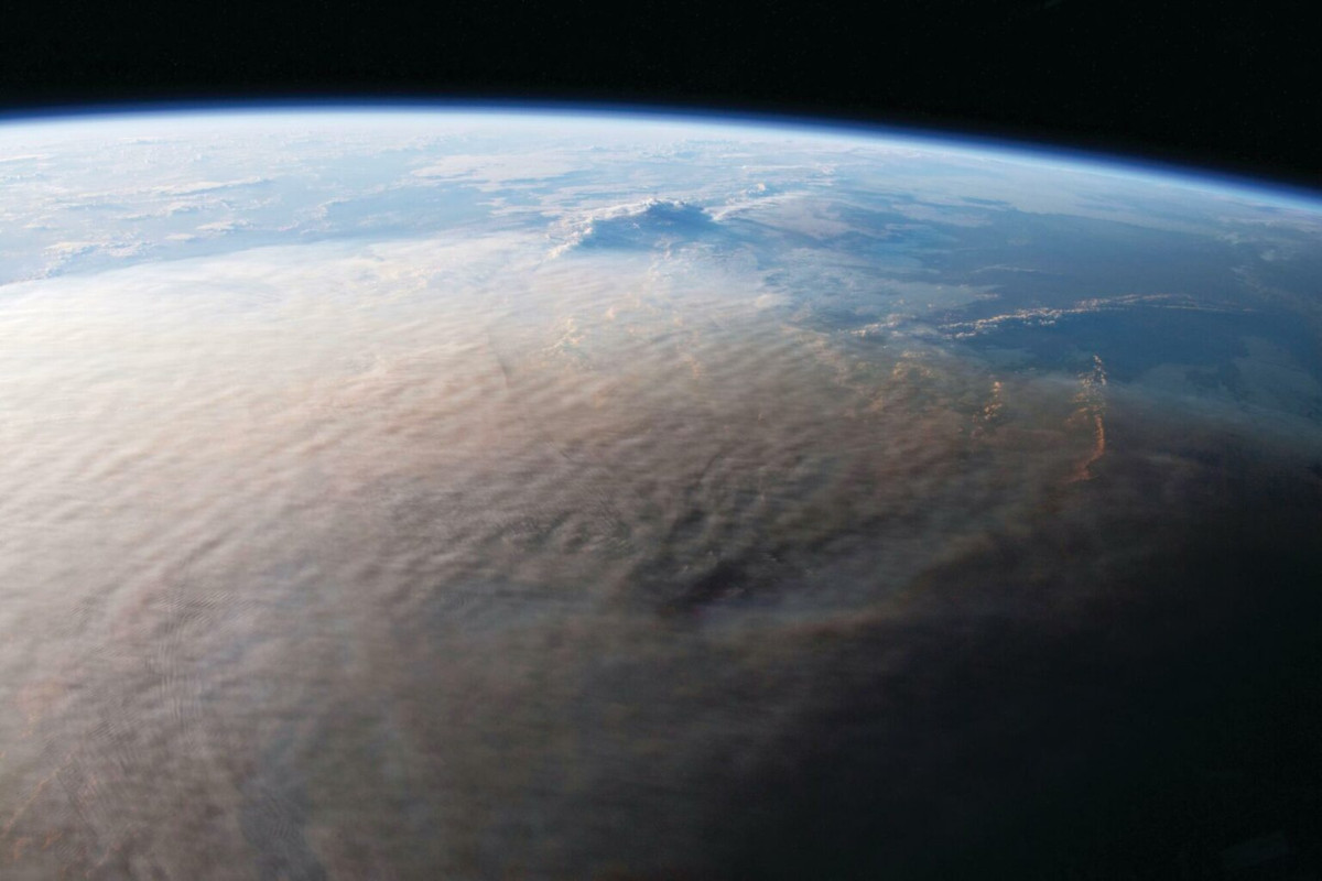
PyroCbs, however, take the potential reach of a wildfire to a whole new level. By pumping colossal quantities of smoke into the stratosphere, where high-altitude winds can carry it far and wide, the clouds can extend a wildfire’s potential impact around the entire planet, or a large part thereof.
In fact, wildfire PyroCbs are now thought to be as effective at getting particulate material into the stratosphere as a large volcanic eruption.
Those making up the Australian super outbreak of 2019–20, for example, injected around a million tonnes of smoke particles into the lower stratosphere over the course of a few days, which – over the following three months – spread out to cover much of the southern hemisphere.
The smoke particle clouds from other PyroCbs have remained in the atmosphere for more than a year before dispersing.
On a small scale, this is representative of what we would expect following a large-scale nuclear war; dust and smoke blasted into the stratosphere shrouding the planet, blocking out the Sun and heralding a so-called nuclear winter.
Similarly, a volcanic winter is the legacy of a rare super-eruption.
The injection of particles into the stratosphere drives global cooling because they’re especially effective at reflecting incoming solar radiation back into space.
In other words, they form a high-altitude veil that reduces the amount of heat from the Sun reaching the surface.
There’s no sign yet to suggest that the PyroCbs spawned by the increasingly intense fires accompanying global heating are having a cooling effect. They likely do little to slow the build-up of heat in any case.
This is because the fires that hatch them also produce immense quantities of carbon dioxide – the principal greenhouse gas behind global heating.
Between 2002 and 2022, it’s estimated that wildfires expelled around 12 billion tonnes of CO₂ each year.
Bearing in mind that the total amount of carbon dioxide released in 2024 due to the burning of all fossil fuels was 38 billion tonnes, this is both an impressive and worrying figure – even if much of the gas is ultimately reabsorbed by burned vegetation as it grows back.
A planetary threat
So, what of the future? There is, as yet, no discernible trend in PyroCb formation, and the record to date reveals significant variation from one year to the next.
There’s no doubt, however, that wildfires are becoming bigger and more intense as the planet gets hotter, particularly in forested areas and at higher latitudes. It would be reasonable to expect this to translate overall into more and bigger PyroCbs.
This, in turn, would result in the uplift of more particles into the stratosphere, magnifying the influence of wildfires on the global climate.
While significant cooling isn’t on the cards, the increased load of smoke and soot particles in the stratosphere may influence weather patterns and cloud formation, and even – through chemical reactions – the weakening of the protective ozone layer.
Given all this, it would seem wise to incorporate PyroCbs and their impacts on the atmosphere into the next generation of climate models.
Pyrocumulonimbus clouds, then, are here to stay. So, is there anything we can do to limit their ability to make big fires even worse?
As Prof Sharples points out, “The only real way you can stop them is five years before they start”. In other words, if you can prevent a major fire from developing in the first place, then you’ll also nip any resulting PyroCbs in the bud.
This, however, is a huge ask at a time when global heating is driving conditions that favour wildfire formation – in particular via so-called ‘whiplash’ weather.
This involves a dramatic switch between very wet conditions, which promote verdant vegetation growth, to extreme drought, which transforms the new plant life into a tinder box.
Better forest management, the construction of fire breaks and improved monitoring by plane and satellite, all have parts to play in keeping the lid on wildfire ignition and growth, but in the worst affected places – like Australia and California – it’s becoming a bit of a losing battle.
Increasingly, as shown by fires encroaching on the suburbs of Los Angeles, San Diego and Sydney in just 2025 alone, major population centres are now coming under serious threat.
It can only be a matter of time before a monster wildfire, aided and abetted by its PyroCb above, rampages across a city boundary, bringing devastation on a scale never seen before.
Read more: